The previous massive winter forecasts can be found at:
http://www.landscheidt.info/?q=node/224
http://www.landscheidt.info/?q=node/189
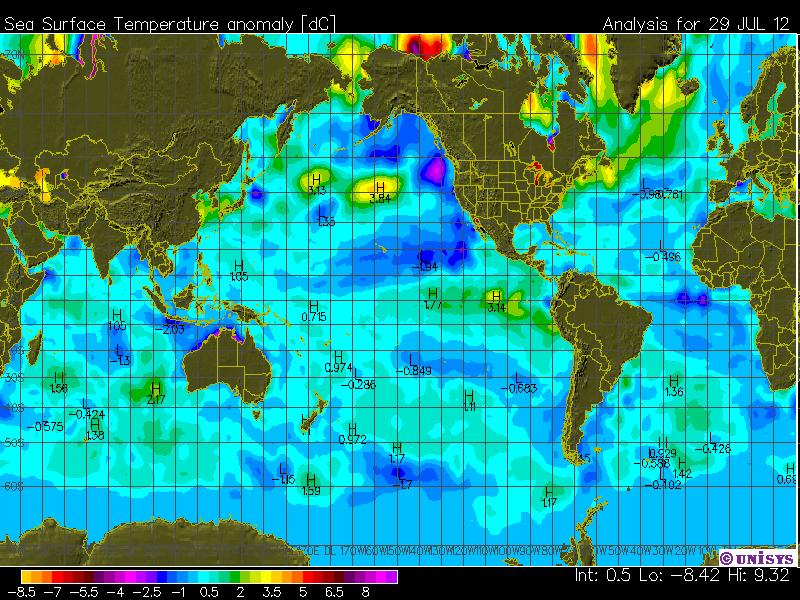
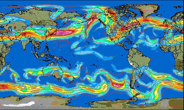
The Worlds oceans as of July 2012 above.
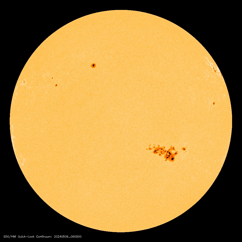
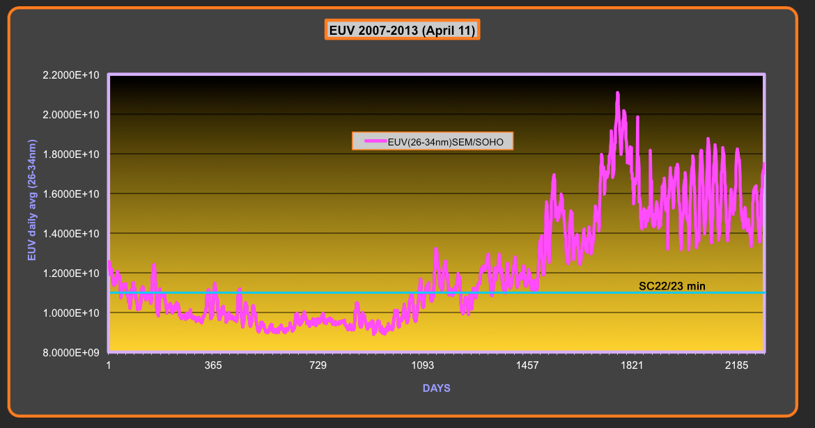
The coming winter in the Northern Hemisphere looks to be shaping up for another massive event perhaps bigger than what we experienced in 2011/2012. The last winter coincided with the highest level of EUV and FUV since the beginning of SC24 which although low by normal standards the current UV level is trending quite a bit lower. In fact the current level is not far above the SC22/23 minimum. At present the EUV levels are less than half of the values recorded during the peak of SC23.
There is strong evidence that low EUV and FUV are major players in determining the jet stream position and strength along with major changes to ozone quantities at different levels of the atmosphere. UV also has an influence on the NH polar vortex which when the conditions are right favoring a negative AO over the winter months. When both of these options come together the greatest effect is felt in the Northern Hemisphere. During the summer in the NH and the winter at present in the SH the mainstream media are picking up the relevance of the jet stream patterns that are occurring. This is a shift from the previous year of not only of the knowledge gained but also of the increased activity of the jet stream through 2012. If this pattern continues into 2013 we should witness some big extremes in weather with blocking highs and masses of cold air feeding from the poles.
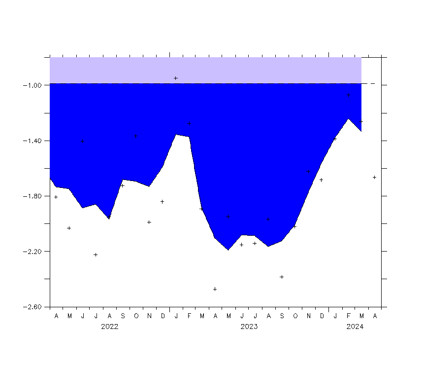
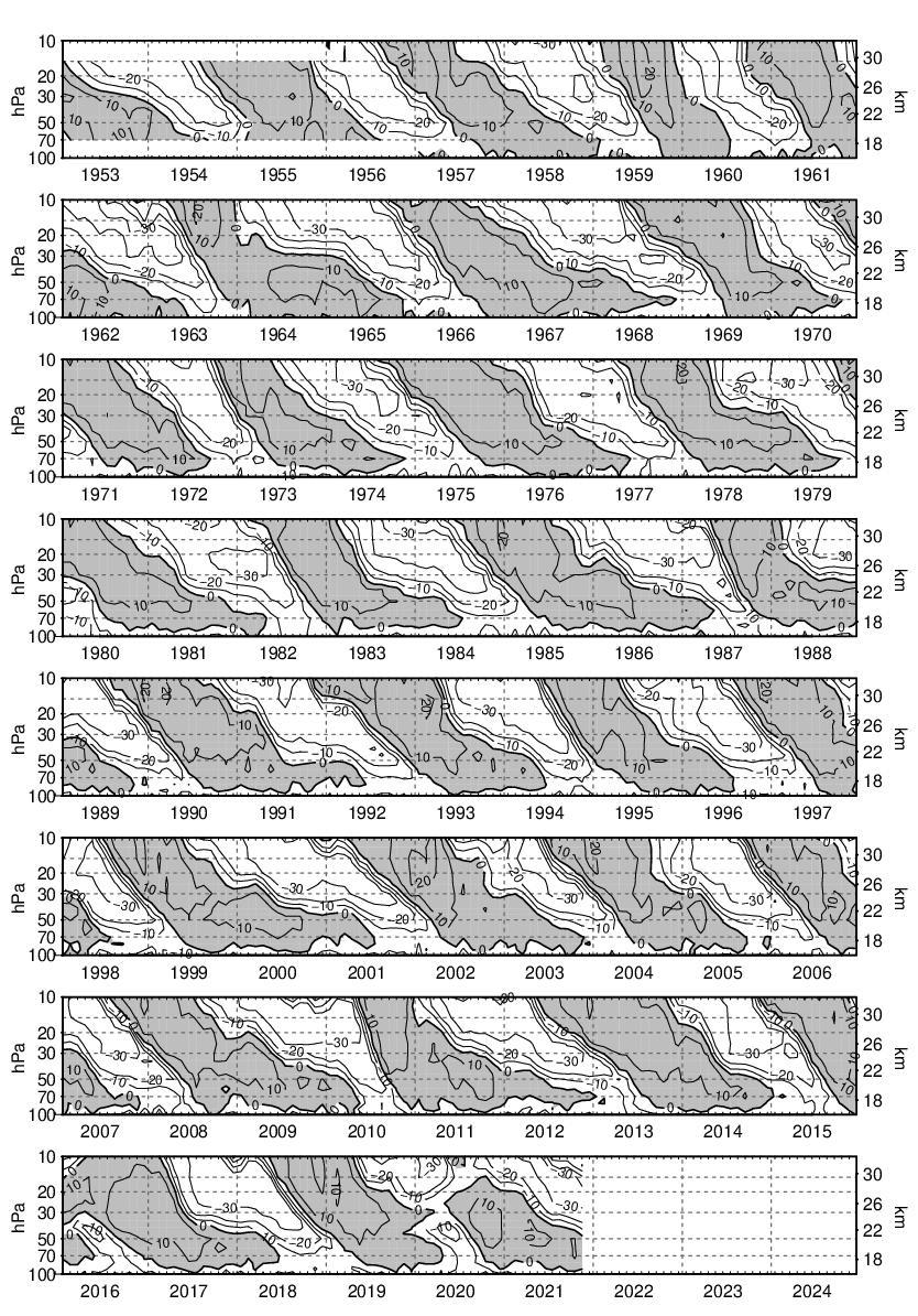
Last season was mixed with most of the USA getting off with a warm winter, but other parts of Europe, Asia and Alaska experienced the massive event which was named the "Great Winter Freeze of 2012". The position of the jet stream was the culprit of the mixed weather which mainly saw a positive AO, but this season has the chance of being different. The quasi-biennial oscillation (QBO) is a quasi-periodic oscillation of the equatorial zonal wind between easterlies and westerlies in the tropical stratosphere which last season mostly favored the formation of a positive AO. When the QBO is in easterly mode the planetary waves that disrupt the NH polar vortex are more likely to occur which tends to produce a negative AO. A negative AO in the past few winters has positioned the jet stream so that the USA and western Europe feel the worst of the Arctic cold air movement and blocking highs that perpetuate this event. The current and expected position of the QBO is looking to favor a negative AO this season. The white area is the easterly flow.
If the UV levels are still low by December which is the current trend the liklyhood of advanced jet stream formation and a negative AO are highly possible and most likely to occur. The ENSO position will also play a role but more on a local scale. Some of the coldest temperatures recorded in the UK occurred in Dec 2010 when we were in El Nino territory. All the models that are produced by the meteorology groups are pointing towards a El Nino forming this winter in the NH. I am not so sure the models have the all required data to predict accurately as we are in a different para-dime with low solar output and a neg PDO. Most that ascribe to AGW ignore the effects of solar and ocean influences on climate and prefer to claim everything is man made, the models suffer the same fate in my opinion.
The ocean temp anomaly diagram at the opening of this article shows a neg PDO position which has the customary hot spot in the central northern pacific. Last year the prevailing winds that come with a neg PDO moved some of this warm water towards New Guinea which in turn fueled the Walker circulation pump that drives the trade winds which in turn builds up water against Asia and influences the level of the Thermocline. This pushes cold water from below that surfaces off the South American coast and flows towards Asia with assistance of the trade winds. It is still too early to call but July has seen a change with the SOI going positive and the trade winds are maintained. There is still a high chance of a La Nina forming which would make three in a row.
Even if a weak El Nino forms and the QBO has no effect on the AO position the jet streams will still play a major role in forming massive winter events, that should be with us for the next 20 years at least if my solar predictions continue to play out. So far everything is right on track.


The World Oceans today.